Executive Summary
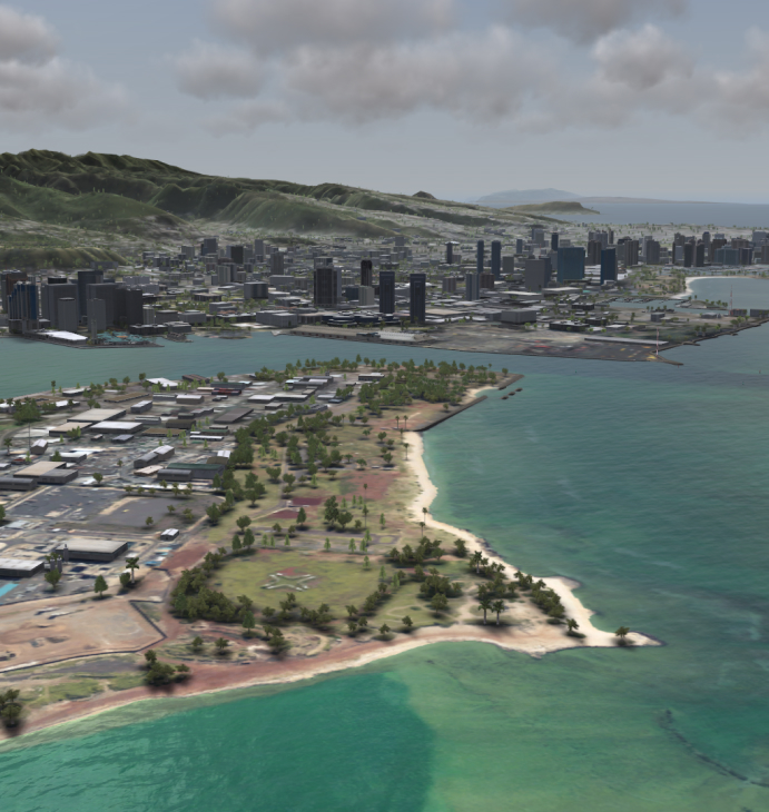
Traditional command and control methods are time-consuming and rely heavily on human resources. U.S. Special Operations Command leveraged Aechelon Technology’s visualization products to improve situational awareness and enable more realistic mission rehearsal, allowing pilots and aircrew to practice missions with real-time intelligence data. This reduced decision-making time and provided intuitive perception and real-time reactions to events. Aechelon’s forward-deployed virtual sand table also allowed for multi-level command and control in one location to support local or remote collaboration.
Expanded Summary
Traditional command and control methods rely heavily on human resources and are time-consuming. Aechelon’s visualization products and solutions address these challenges with two main capabilities: mission rehearsal and situational awareness.
Mission Rehearsal: For over 14 years, Aechelon’s solutions have been used by the U.S. Special Operations Command to allow pilots and aircrew to pre-fly missions in simulators with the most current intelligence data before flying actual missions. This minimizes the reliance on labor-intensive and time-consuming approaches, improving the efficiency and effectiveness of mission planning.
Situational Awareness: Aechelon’s technology provides an on-the-edge capability that uses natural human vision to see a fused, in-context perspective of the scenario. This includes terrain and sensor views, live tracking of vehicles, and live video fusion of all sensors. This comprehensive situational awareness capability enables users to have an intuitive perception of friendly and enemy forces’ locations in context with the terrain. It also provides real time visualization of video feeds with tactical network symbols, pre-visualization of sensor visibility, and multiple commander interactions within the 3D terrain—both in person and remotely.
These features contribute to reduced, intuitive decision-making time for operational groups, immediate reaction on the kill chain for safety or protection from friendly fire, and civilian uses such as search and rescue coordination and forest fire management. Aero-turbulence visualization is also provided, allowing users to anticipate the expected outflows of landing areas.
One example of Aechelon’s technology in action is our forward-deployed virtual sand table. This tool is designed for multi-level command and control, allowing experts to see all information in one place at the tactical edge of the battlespace. The data/image generators are decoupled from the display, enabling forward virtual deployment in austere environments without exposing the original data. The bandwidth is compatible with satellite-based SpaceX Starlink systems, ensuring minimal transport delay. Users can walk around, collaborate, and point to objects locally and remotely—promoting more efficient communication and decision-making.
Problem/Challenge
- Typically, command and control and mission planning have been limited to long iterations and not-in-context data feeds—limiting decision-makers and intelligence exploitation to relying primarily on overloaded human resources.
- Consequently, the challenge has been to provide realistic mission rehearsal capabilities to minimize reliance on labor-intensive, time-consuming approaches.
Solution/Impact
Aechelon’s pilot and sensor visualization products and solutions provide mission rehearsal and situational awareness capabilities:
- Mission Rehearsal: Fully deployed and used by the U.S. Special Operations Command during the last 14 years, allowing pilots and aircrew to pre-fly missions in simulators with the most current intelligence data before flying missions in actual aircraft.
- Situational Awareness: On-the-edge capability using natural human vision to see a fused in-context perspective of the scenario. Mission-critical situational awareness includes terrain views, sensor views, live tracking of vehicles in context, and live video fusion of all sensors. This enables:
- Intuitive perception of forces (friendly and enemy) locations in context with the terrain
- Live visualization of video feeds in context with symbols from tactical networks—e.g., blue force tracker
- Pre-visualization of visibility between/among sensors from different points of view
- Multiple commander interactions in-person or remotely within the 3D terrain
- Reduced intuitive decision-making time as an operational group
- Immediate reaction on the kill chain for safety or protection of friendly fire
- Civilian uses for search and rescue coordination and forest fires
- Aero-turbulence visualization of expected outflows of landing areas
Example: Forward-Deployed Virtual Sand Table
- Aechelon’s forward-deployed virtual sand table is designed for multi-level command and control, enabling experts to see all information in one place at the tactical edge of the battlespace.
- Data/image generators are decoupled from the display, enabling forward virtual deployment in austere environments without exposing the original data.
- Bandwidth is compatible with satellite-based SpaceX Starlink and does not incur any perceived transport delay.
- Users can walk around, collaborate & point to objects locally or remotely.

