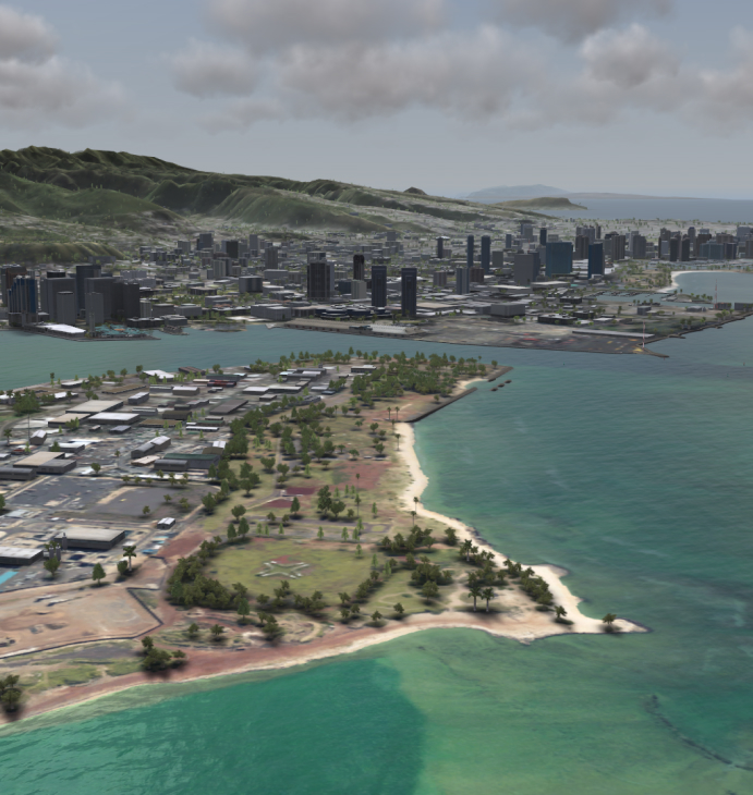
Geo-Specific, Multi- Sensor and Radar Worldwide Databases
Used to enhance Synthetic Reality, Mixed Reality and flight simulation alike, Aechelon’s geo-specific 3D worldwide database provide ultra-realistic, highly detailed depictions of real-world global environments.
Customers use Aechelon’s geo-specific data solutions to conduct realistic mission rehearsal across multi-spectral real-world environments, complete with real-time, drone-fed visualization for critical situational awareness during virtual ISR exercises.
These databases can even be used to achieve unmatched AI and ML model training reliability for defense and commercial use-cases alike.
The Aechelon data solution offers worldwide content coverage with worst case resolution of 2 Meters multi-spectral imagery background, before blending areas of interest at inches resolution from satellite and aerial imagery and 1 Meter terrain elevation prior to insert sub-millimeter 3D features.
This extraordinary platform for Synthetic Reality provides high-quality visibility into the most minute details of terrain and tactical data that is the hallmark of all Aechelon solutions.
Industry-leading machine learning, broad area derived features and high-detail areas of interest plus geo-specific modelling.
Product Specifications
- Unparalleled geo-specific multi-sensor and radar worldwide database
- Access to Petabytes of high-density data
- Coverage, content and custom production available upon request
Supporting Products
Image and Data
Generation
Synthetic Reality visual simulation drives both situational awareness and faster decision making, while also enabling AI/ML training.
Shared, Secure
Storage
Operate with confidence knowing tactical systems are protected by data-center-grade shared and secure storage systems with encryption and governmental-level physical security access.

